
Two wave exploration flights Jan 16, '25, Brian Hart & Banyan Carman
The day began with a deep dive into Skysight and other weather tools at the sim room in an attempt to tie out the weather predictions to actual conditions. The goal was to work out a proof of concept for the pure gliders by towing to a predefined place within ridge lift or the lower wave and work from there up into the primary wave over Mt Adams and/or Mt Hood.
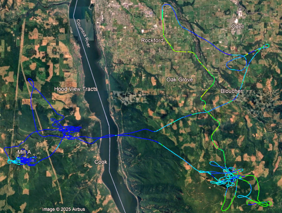
On flight #1, we took off at 10:00 and zigzagged our wave up the terrain over Kingsley Reservoir, six nm WSW of the airport. Reservoir is about 3200 MSL, and we persevered through heavy rotor getting there. The air went smooth at 5000 MSL, so we shut down the engine in the wave—and then worked our way all the way down to 4000’ —again in heavy rotor. So I restarted the engine and climbed a bit higher, this time not shutting down until we were at about 6000’. That all took 23 minutes. Then we puttered around over Kingsley a bit, getting up to about 6850, at which time it seemed evident that this was the top of the lift or that the lift pockets were too narrow to navigate effectively.
So after 20 minutes of that, we turned our back on Kingsley and Defiance and headed across the river to try the wave east of Dog Mountain. We found our first wave there just east of Cook Hill at 5800—we had lost 1000’ in constant two-knot sink crossing the river. We worked our way back up only to about 6800 when we again found we were at the top. We tried running downwind to the next wave—but after less than two minutes with a groundspeed of 100+ knots, we turned back at 5700’ and persevered now back into the headwind at a groundspeed of about 30 knots into the lift again. By the time we got into lift again behind Dog Mountain, we were at 4800’. More working the wave, include a run northwest to the wave behind Augspurger Mountain, and we got up to about 5900’ before it became clear that we had no good path to transition to the Trout Lake or Mount Adams wave and headed back to land and take a break.
On our second flight, we turned our attention south with the goal of getting into the wave under 7000’ over the lava flow, connecting to the primary wave east of Mount Hood, going up to 17,600’, then soaring the wave to Mount Jefferson and back. Again, the goal was to demonstrate what might be done in a pure glider with a prudent release altitude and location.
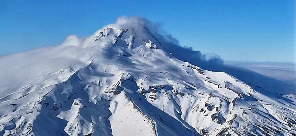
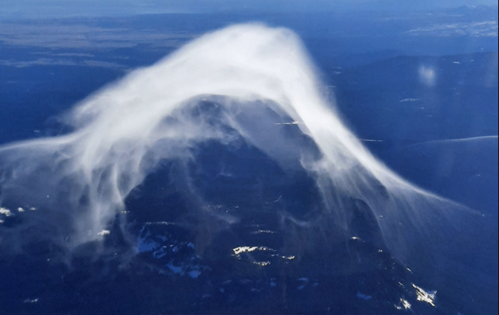
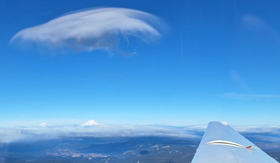
In the first part of this goal, we were successful; we launched about 13:13 and climbed toward the lava flow, then shut the engine down at 6100’ 15 minutes later and turned south toward Hood. Although our altitude was sufficient, we had not gotten far enough south to connect us to the Mount Hood wave by the time we ended up at 4500’ in rotor beneath the wave. So we restarted and climbed south another couple of miles to about 6000’ a mile east of Lawrence Lake, where we again shut down the engine. Now we were able to climb in moderate lift to 9000’, the whole time watching this cloud repeatedly form and disappear directly east of Mount Hood.
We correctly surmised that the west edge of that cloud was just under the wave and that it was time to turn our attention to that primary Hood wave. So we set our ground track to a point just west of the cloud and arrived in front of that cloud at about 11,500. So we were able to connect from 6000’ over the middle of the lava flow to the primary wave over Mount Hood.
I contacted Seattle Center on 119.65 to apprise them of our position and “negative transponder”, then we surfed the front of that wave just west of Bluegrass Ridge, four miles east of the peak, for half an hour, departing south toward Jefferson at 17,800 at 80 knots to avoid breaching Class A.
But alas, the specter of intense headwind later in the flight in my mind, and thus reticent to fly too far east downwind, we ended up flying mostly south in sink and turned back at 14,500—only to arrive back in the primary Mount Hood wave at 8800. So we had lost almost 9000’ in 20 minutes!
This time, a single slow pass through the lift without turns had gained us almost 4000’. With the cover moving in over the airport at 4300’, we figured it would be ill-advised to continue our well-earned ascent back up to the floor of Class A and instead turned our attention to how we could lose 8000’ in nine miles to tuck in under the ceiling before the entire valley closed in.
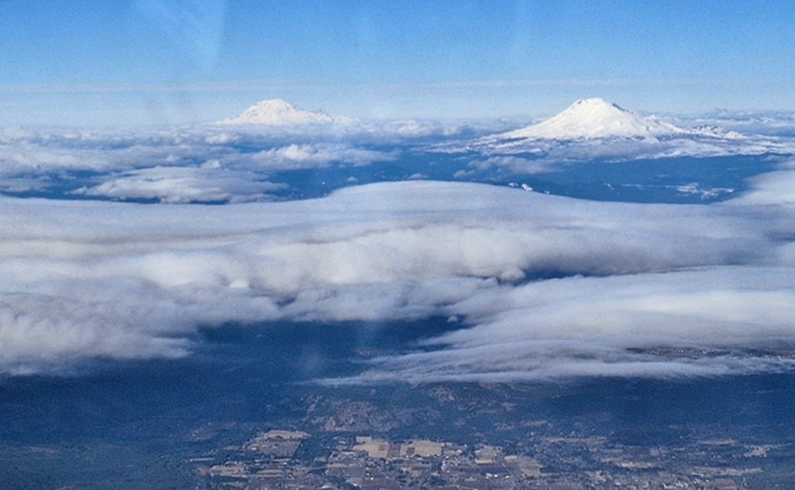
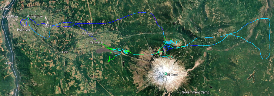
Then, naturally enough, it was lift all around and clearly time to involve additional tools in our get-down-quickly strategy. So we headed east looking for the downwind wave sink, then with full spoilers, practiced full left and then right forward slips, eventually seeing a sink rate of over 2000 feet per minutes. When I came out of the slip and put spoilers away at 6000’ four miles south of Baldie, I found to my chagrin that we had indeed also found the sink; we continued sinking at 10 knots behind the ridge, crabbing hard to get in front of the ridge—with a groundspeed under 30, making our effective glideslope over the ground something like 13! So then I restarted the engine sooner than I had intended in order to penetrate the wind and cruise on back to the airport. I certainly would not have flown that profile in a pure glider, and it is a lesson for next time: keep that headwind-assisted glide slope degradation at top of mind in major intentional wave descents.
So Banyan got in about 4-1/2 hours of training toward his self-launch endorsement, and I got to add a bit more information about how to piece together the lift in ways that can allow us to maximize the value of our tows! Except for missing out on the wave south of Hood and allowing too much downwind drift during our fast descent, both those flights demonstrated what we were after: that a moderate-altitude tow to an auspicious location would certainly allow a pure glider to soar these conditions to great heights and distances. And the Skysight predictions, if anything, underpredicted the wave strength.